Find Your Daily Voice
GO
Villas-Lower Township, NJ
Weather
It's Time To 'Spring Forward,' But Storm Packed With Strong Winds Is Coming
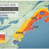
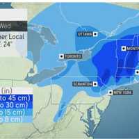
We're just hours away from the start of Daylight saving time with clocks moving ahead one hour at 2 a.m. Sunday, March 12. Though it's "Spring Forward" time, a potent storm that will be packed with a mix of snow, sleet, rain, and strong winds that could cause power outages is headed to the region. The time frame for the storm is Monday, March 13 into Tuesday, March 14, according to the National Weather Service. A look at projected snowfall totals from the early week Nor'easter.AccuWeather.com It will be the second winter storm in the span of days as the weekend is off to a messy storm…
White Plains, NY
Weather
It's Time To 'Spring Forward,' But Potent Nor'easter Packed With Snow, Strong Winds Is Coming
We're just hours away from the start of Daylight saving time with clocks moving ahead one hour at 2 a.m. Sunday, March 12. Though it's "Spring Forward" time, a potent Nor'easter that will be packed with a mix of snow, sleet, rain, and strong winds that could cause power outages is headed to the region. The time frame for the storm is Monday, March 13 into Tuesday, March 14, according to the National Weather Service. It will be the second winter storm in the span of days as the weekend is off to a messy storm thanks to a system that is now gradually winding down after bringing li…
Brentwood, NY
Weather
Wet, Windy Mess: Here's How Long Potent Nor'easter Will Linger
A nasty Nor'easter bringing a mix of rain, sleet, and snow along with gusty winds will linger throughout the day on Friday, Dec. 16. Projected, and simulated radar for 5 p.m. Friday, Dec. 16, showing a mix of snow and sleet (blue and light blue), rain (green), and heavy rain (dark green) is shown in the first image above. "Lingering showers and gusty winds persist much of today," the National Weather Service said. "Winds along the coastline occasionally gust up to 50 mph into this afternoon, before tapering off this evening." Rain could. be heavy at times with up to 2 inches possible…
Poughkeepsie, NY
Weather
Potentially Severe Storm Could Cause Power Outages, Central Hudson Warns
A Nor'easter that is expected to move through the area and dump up to 18 inches of snow in some spots farthest north could also cause power outages and downed trees. Due to the latest projections on the storm, which is forecast to move through the area on Thursday, Dec. 15 into Friday, Dec. 16, Central Hudson Gas & Electric Corporation is advising customers to prepare for potentially severe winter weather. Forecasts are calling for a wintry mix that could bring heavy, wet snow to areas of higher elevation west of the Hudson River and a mix of rain and snow throughout the valleys and oth…
Brentwood, NY
Weather
Projections Updated For Nor'easter That Will Bring Up To 18 Inches Of Snow To Some Spots
A potent storm system that started out with blizzard-like conditions in the Midwest and fatal tornadoes in the South has the potential to dump as much as 18 inches of snow in more areas than earlier projected in the Northeast, according to AccuWeather.com. The system is due to arrive from west to east Thursday, Dec. 15, and linger into Friday, Dec. 16. In coastal areas along the I-95 corridor, mainly rain and possible sleet are expected from the system, according to the National Weather Service, which noted the rain could. be heavy at times with up to 2 inches possible, alon…
Brentwood, NY
Weather
Some Areas Could See Up To 18 Inches Of Snowfall From Potent Nor'easter Taking Aim On Region
A storm system that will sweep through the Northeast could bring up to 18 inches of snowfall to some interior areas in the region, according to brand-new predictions. The system is on track for Thursday, Dec. 15 into Friday, Dec. 16. In coastal areas along the I-95 corridor, mainly rain and possible sleet are expected from the system, according to the National Weather Service. But farther inland, parts of northern New York, New England, and Pennsylvania could see at least a foot of accumulation from the Nor'easter. Projected accumulation totals are shown in the image above…
White Plains, NY
Weather
Rare Summer Nor'easter Could Be Headed To Region, Forecasters Say
New update: Projected Track Develops For Potential Rare Summer Nor'easter A pleasant, dry weekend marked by refreshing air with low humidity will be followed by the chance for a rare summer Nor'easter, according to forecasters. Sunday, Aug. 14 will be mostly sunny with a high temperature in the low 80s and calm winds. Clouds will thicken a bit on Monday, Aug. 15, which will be partly sunny, with a high temperature near 80 degrees, and a chance of showers in the afternoon and evening. A storm developing across the mid-Atlantic on Monday will threaten this region on both Tuesday, A…
White Plains, NY
Weather
Heavy Rain Causes Flooding In Parts Of Region; Here's Long-Range Outlook As Storm Moves Out
A potent Nor'easter that swept through the region overnight is now pushing off the coast, with its heavy rains causing flooding on roadways and low-lying areas in parts of the area and its gusty winds leading to power outages. Conditions will remain blustery on Tuesday, April 19, with winds out of the Northeast at speeds of around 15 miles per hour with gusts as high as 30 mph at times, according to the National Weather Service. It will be cloudy throughout the day with a high temperature in the low to mid 50s. After rain and showers from the storm taper off around mid-morning, there …
White Plains, NY
Weather
Here's Timing For Massive Nor'easter Bringing Damaging Winds That Could Knock Out Power
A quick-moving, multi-faceted Nor'easter will bring heavy rain, possible flooding, damaging winds that could knock out power, with some areas farther north seeing significant snowfall. The current projected time frame for the storm is from early Monday evening, April 18 until around 8 a.m. Tuesday, April 19. Rainfall totals from the system will be between 1 and 2 inches. Wind gusts during the height of the storm will be upwards of 30 miles per hour, and as high as 50 mph in some spots. "Gusty winds could blow around unsecured objects," the National Weather Service said in a Haz…
Glen Burnie, MD
Weather
Post-Easter Nor'easter? Brace For Freezing Temps, Wintry Mix
A post-Easter Nor'easter could dump snow on parts of the region this week as winter clings on for dear life, AccuWeather meteorologists say. The projected time frame for the storm is from early Monday evening, April 18 until around midday on Tuesday, April 19. Rain and thunderstorms were likely in New Jersey, Maryland and the Philadelphia region, save for a wintry mix including snow in much of Central PA, forecasters say. Easter Sunday, April 17 will be mostly sunny and brisk with a high temperature only in the upper 40s, according to the National Weather Service. Freeze watche…
White Plains, NY
Weather
Projections For Snowfall, Timing Released As Post-Easter Nor'easter With Damaging Winds Nears
It's snow joke. A post-Easter Nor'easter will dump as much as a foot of snow in parts of upstate New York and northern New England, with heavy rain in store for the rest of the region. The current projected time frame for the storm is from early Monday evening, April 18 until around midday on Tuesday, April 19. It's expected to bring rain and thunderstorms, along with snow showers and snow. "Nor’easters can mean heavy snow for the I-95 corridor in winter; but, now that we are well into April, most areas near the coast from southern New England to the mid-Atlantic are in line to see just ra…
White Plains, NY
Weather
Arrival Of Colder Air Will Bring Chances For Snow In Some Spots As Potential Nor'easter Nears
The arrival of colder air will bring with it chances for some snow in parts of the region nearly a month after the start of spring and leading into the arrival of a potential Nor'easter. "Spring is often a tug-of-war between winter and summer, but many might think snow is usually a thing of the past by the middle of April in much of the Northeast," according to AccuWeather.com. "However, that is often not the case as evidenced by the upcoming weather pattern, which will follow several days of warm weather that brought the return of 70-degree temperatures for some." Saturday, April 16 will b…
Next Page
Archive